ACE Report: El Niño
Open Google Doc of El Niño
By Rebecca Anderson, ACE Director of Education
Let’s start with a definition of terms:
El Niño: “The Boy” or, to quote Chris Farley: “For those of you who don’t habla 
(Apparently, this term refers specifically to the Christ child because El Niño events used to become noticeable around Christmas.)
La Niña: “The Girl” – The opposite phase of El Niño. But, as I learned today, it’s not always either a La Niña or El Niño year. Often we can be in a neutral, “normal” phase that’s in between.
ENSO: El Niño Southern Oscillation. This is the term most scientists use for El Niño, because the “southern oscillation” part includes what’s happening in the atmosphere, too, not just the ocean. (And these two things are inextricably linked.)
An El Niño occurs when some funky stuff happens in the Pacific Ocean around the equator. But before we tackle what an El Niño is, we have to understand what “normal” is.
Normal, non-El Niño conditions
Under “normal” conditions in the equatorial Pacific Ocean, winds blow from east to west. As these winds blow against the surface of the ocean, they push the water at the surface in the same direction they’re going. This pushes warm surface water across the ocean from the coast of South America towards Australia and Indonesia.
So, “normal” conditions mean warm water building up on the west side of the Pacific near Australia and cold water coming to the surface in the east. The water can be 8ºC warmer on the west side of the ocean than in the east. And the wind really does push the water to the west, too – the sea surface can be 0.5 meters higher in the west than in the east.
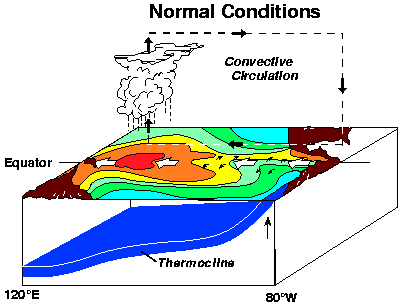
All that warm water in the west loves to evaporate and then rain back out, which keeps Indonesia nice and wet and the coast of South America relatively dry.
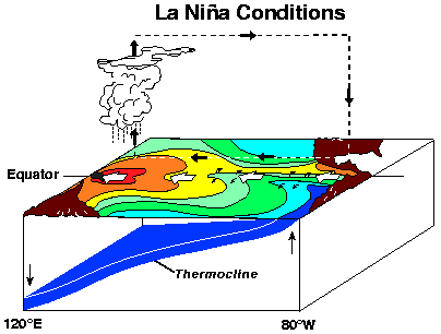
Note: The thermocline is a line showing at what depth a given temperature is in the ocean. Think of it like a contour line on a topographic map, except showing temperature instead of elevation. So, in this picture, the thermocline at temperature Xº is deeper on the west side and it’s right at the surface in the east, meaning that there’s relatively cool water at the surface in the east and warm in the west. Compare this to the next picture of an El Niño situation…
El Niño
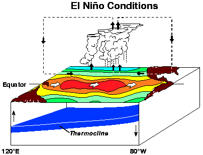
Here’s what happens during an El Niño: The east-west trade winds slow down. This then stops the flow of warm surface water across the ocean and instead, that warm water just sits there. And because that warm water isn’t moving out of the way, there’s no room for the cold, deep water to come up to the surface along the coast of South America. Which means those key nutrients don’t come with it, nor do the fish and people’s food and livelihoods, too.
Now to what’s going on in the atmosphere: Because there’s now a warm pool of water sitting all across the equator in the Pacific, evaporation drives formation of rain clouds over the middle of the Pacific, not the west, which shifts the pattern of rain away from Indonesia and towards South America. This brings drought conditions to Indonesia and Australia and more rain and floods to South America.
Note how the thermocline is flatter here, because the water temperatures are the same across the Pacific. No more cold water coming to the surface near South America.
What about La Niña?
Think of La Niña as just an extreme version of normal with above normal east-west temperature differences.
What does climate change mean for El Niño?
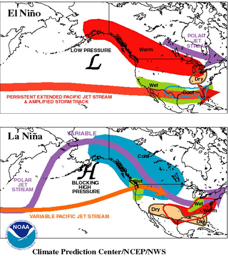
The big deal about El Niño is that it affects global climate and weather patterns, not just in the equatorial Pacific. El Niños can change the strength and position of the jet stream across the U.S., too. It tends to mean that wet places (think Pacific Northwest) get dry and dry places (desert Southwest) get wet. See the image from NASA for more details.
The state of El Niño is constantly changing. Check out where we are today on NOAA’s ENSO page. The red parts of the graph are El Niños, the blue are La Niñas.
El Niño
Student Worksheet
Name:
1. What (or who) does the term El Niño refer to? Why?
2. Under “normal” (non-El Niño) conditions, what does the wind do?
3. The above wind pushes lots of warm water from the surface. How does this affect the cold water underneath? What is this cold water called?
4. What is the effect of the cold water current in terms of food?
5. In terms of climate, these winds and ocean currents keep Indonesia (western Pacific) _________ and coastal South America _________.
6. What is the thermocline?
7. During El Niño years, what happens to the trade winds (and thus the pushing of the warm water)?
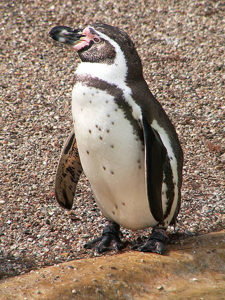
8. Due to the above, what happens to the Humbolt (cold water) current and the food supply during El Niño years?
9. What’s a La Niña?
10. How long does an El Niño typically last?
11. Bonus: What ENSO condition are we in now? (Google it!)